
In August we had a team walk along Gosforth High Street to see if we could come up with some ideas for what could be tried out fairly cheaply as part of the current trial arrangements. In particular we were looking for ideas that wouldn’t require changes to the road layout or need new traffic orders to implement.
Below are 10 ideas, which we hope Newcastle City Council will consider. Most of them, if successful, could be implemented at multiple locations on Gosforth High Street.
If you have any other ideas for small changes that could easily be trialled please let us know in the comments below.
We have commented on the scheme overall in our blogs Gosforth High Street – Good Policy, Terrible Plan, Gosforth High Street has been designed like a bypass rather than a shopping destination and Gosforth High Street – Safety Concerns.
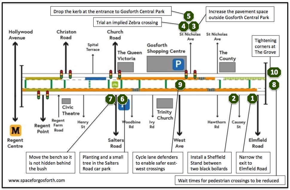
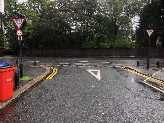
Idea 1. Narrow the exit to Elmfield Road so it is only one vehicle lane. Extend the pavement on the left hand side where the double yellow line is now. Possibly install a Sheffield stand for cycle parking if there is space. Car parking remains unaffected.
Benefit: Shorter, safer crossing for people walking along Gosforth High Street. Additional cycle parking for customers.
2. Install a Sheffield Stand between two black bollards parallel to the road (like on Acorn Road). This would allow some cycle parking without obstructing the pavement.
Benefit: Additional cycle parking for customers.
3. Increase the pavement space outside Gosforth Central Park (picture below). This shouldn’t impact turning vehicles and doesn’t affect access to the shopping centre car park.
Benefit: Improved entrance to the park
4. Trial an implied Zebra crossing, or alternatively a raised crossing, over the entrance to the car park ramp.
Benefit: Safer crossing.
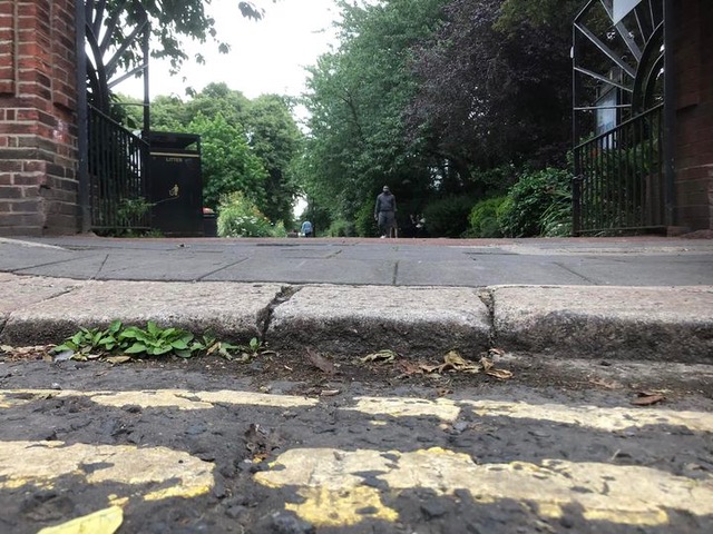
5. Properly drop the kerb at the entrance to Gosforth Central Park for wheeled users, including mobility scooters. (This may not be needed if pavement is extended).
Benefit: Improved access for wheeled users.
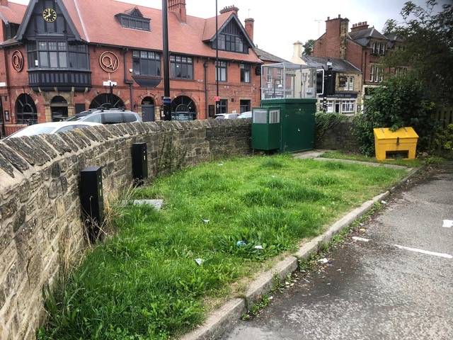
6. There is an opportunity for a bit of planting and a small tree in the Salters Road car park, rather than just grass. This should also reduce maintenance.
Benefit: More greenery
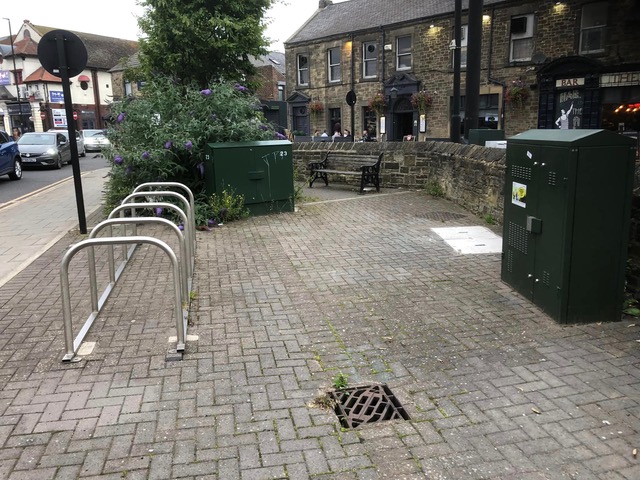
7. Move the bench so it is not hidden behind the bush, possibly to just right of the photo. This is also a really poor location for cycle parking as the racks are not well used (whereas the racks next to the pub are used) so the Council could consider moving these to another location, maybe outside the gym on Ivy Road to replace the poor quality cycle parking currently there?
Benefit: More usable bench and cycle parking.
8. Wait times for pedestrian crossings to be reduced / or to be instant outside of rush hour. The time allowed for pedestrians to cross could also be increased. This is a particular problem at the crossing next to the Little Moor.
Benefit: Better for people walking.
9. Installing cycle lane defenders to enable safer east-west crossings of he High Street by bike. From Ivy Road / West Avenue to St. Nicholas southbound (shown). Elmfield to The Grove north and south bound, Moorfield to Moor Crescent north bound. These are only short sections and are not used for loading or any other purpose so there should be minimal/no conflict of usage.
Benefit: Safer cycling facilities.
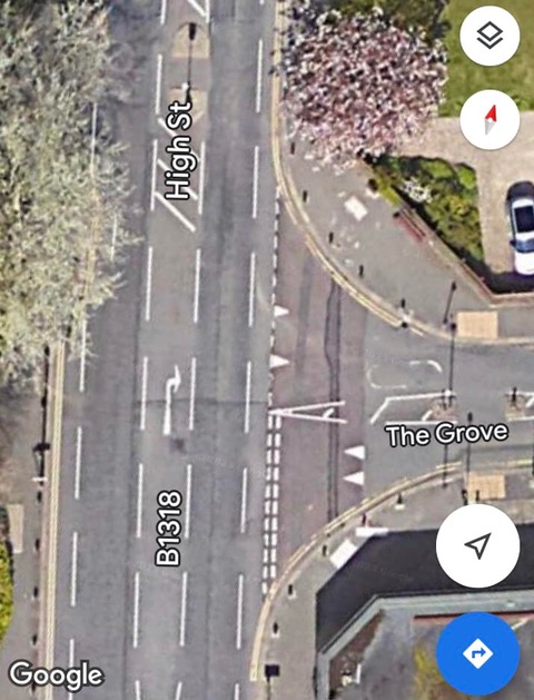
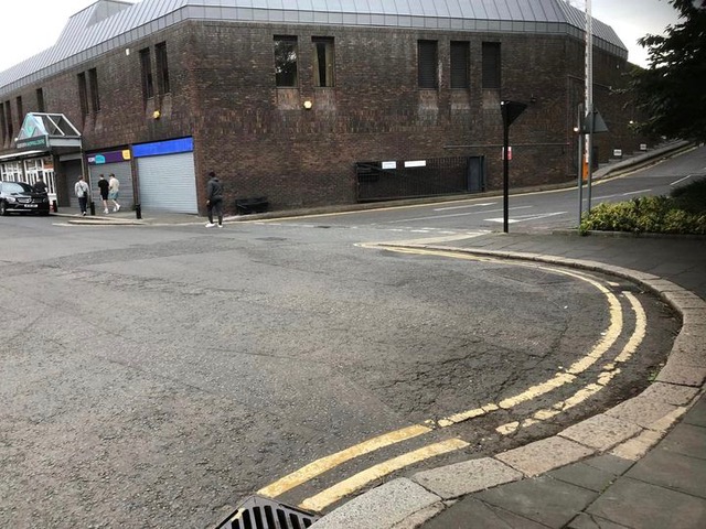
10. Tightening the corners at The Grove. Alternatively, or as well as, at the entrance to the car park immediately north of The County. This would make the junction safer by reducing the speed of turning traffic. Newcastle Council proposed similar measures in 2016 (see https://www.spaceforgosforth.com/pedestrian-priority/).
Benefit: Safer crossing.