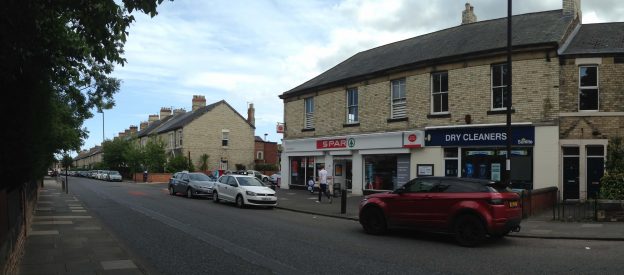
Newcastle City Council are seeking your views on a proposed crossing to be sited on Salters Road. You can access the original consultation, which closed on 23 December 2018, on the Let’s Talk website. The proposal is to remove the zebra crossing and replace it with a puffin crossing outside of the Spar shop.
| Update 3/9/2019: The Council approved the original proposal without modification. |
| Update 21/1/2022: The Council have installed the crossing (see bottom of blog). |
The Council’s reasons for proposing the above crossing are as follows:-
- Requests to review the existing zebra crossing have been received as concerns
were raised that this type of crossing is no longer adequate for the number of
pedestrians using the facility. - Surveys were carried out and in accordance with set criteria, the results showed that
it would be justified for the existing zebra crossing facility to be upgraded to a puffin
crossing. - As the layout of a puffin crossing is slightly wider than the existing crossing, the new
puffin facility could not remain in the same location due to the proximity of residents’
driveways. - It is therefore proposed to remove the existing zebra crossing and introduce a puffin
crossing outside the Spar shop on Salters Road. There are no direct frontages in
this location and the crossing facility could also be useful for pedestrians accessing
the adjacent shops.
Salters Road is a very busy road with parked cars running down its length on the South side from the Jubilee Road junction to High Street junction.
The average weekday traffic volumes (measurement point is not at this location but further up Salters Road – counter 1264 – source: Traffic and Accident Data Unit) are:
- 2015 – 9,959
- 2016 – 9,879
- 2017 – 9,864
This count does not include vehicles joining from Jubilee Road. To put this into perspective 9,864 vehicles is approximately half the vehicles that use Great North Road on an average weekday.
Salters Road is close to several schools and is a daily crossing point for many parents with young children attending Archbald First School and St Charles RC Primary schools, as well as youngsters heading to Gosforth Academy Junior High .
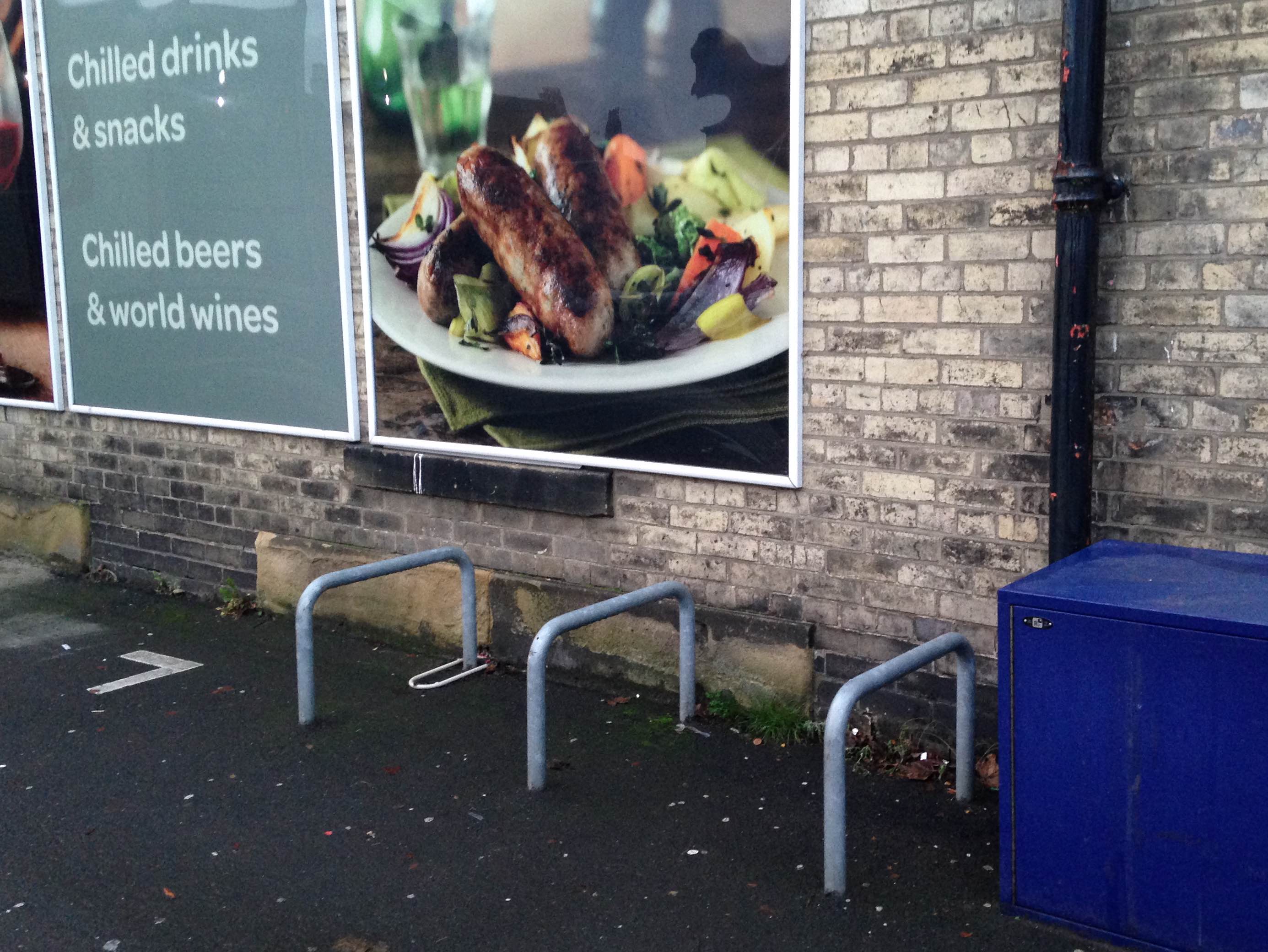
Gosforth Post Office is located in the Spar shop that the proposed crossing will serve.
Recommendations for changes to the proposed plan
SPACE for Gosforth supports the plan for this crossing, which will clearly make crossing this busy road much safer and providing direct access to the Post Office and Spar for all pedestrians. The zig zag lines from the crossing will aid drivers’ sight lines when exiting Ivy Road. A notorious junction for vehicles parking close to the exit.
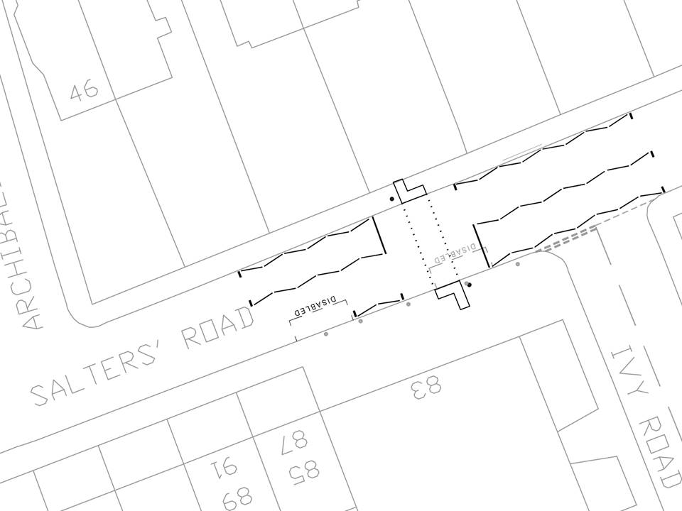
Proposed Puffin Crossing – Salters Road Newcastle City Council – Nov 2019
However, SPACE for Gosforth believe that with the addition of some small changes the crossing and area can be further improved. In the drawing below, SPACE for Gosforth propose the following changes:
- Build out the pavement at the crossing point on the shop side. This will not impede the flow of vehicles. Drivers park the length of Salters Road on the South side and the build out of the pavement improves the sight line for pedestrians without impacting on the width of the road for vehicles. In addition, the build out provides a degree of protection for disabled drivers parking in the space outside of the shop.
- Make the pavement continuous across Ivy Road (as is the case at the opposite end of Ivy Road joining the High Street). This will also slow vehicles down entering the 20mph zone.
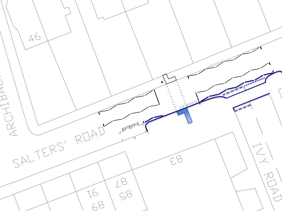
Built out pavement at the crossing point with continuous pavement across Ivy Road.
Extending the design further, adding greenery with planters would dramatically improve the area outside of the shops.
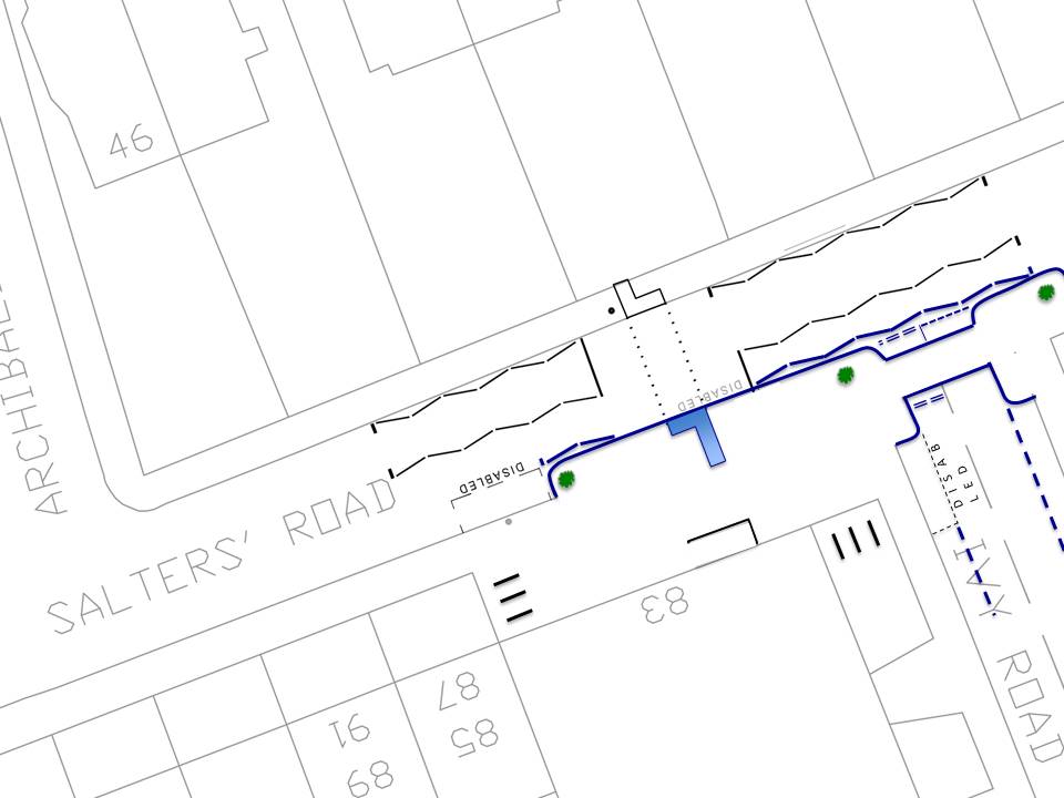
Planters added to plan to improve the environment and make the area more pleasant for customers.
Raising the pavement across the junction with Ivy Road will ensure pedestrian priority and a continuous path for pedestrians, slowing vehicles and increasing safety.
SPACE for Gosforth propose making the crossing over Ivy Road continuous.
Additional Support for the crossing
In addition to our own review SPACE for Gosforth met with representatives from Newcastle Children’s Vision Team and charity Guide Dogs to review the proposed location of the crossing and the area outside of the Spar shop.
The needs of those with a visual impairment should be at the forefront of debate about traffic in Gosforth, not least because three of Gosforth’s schools house Newcastle upon Tyne’s Visual Impairment Additionally Resourced Centres (VI ARCs). As one of our members has previously noted:
“If we can design our streets to meet the needs of the visually impaired it’ll be a much safer and more pleasant place for everyone. This should be the absolute baseline for any changes undertaken.”
Both the Children’s Vision Team and Guide Dogs welcome the crossing. The zebra crossing is challenging and dangerous for people with visual impairments. With the volume of traffic it is difficult to be sure that vehicles have actually stopped to allow safe passage. The Children’s Vision Team work with children in and around this area, familiarising them with their surroundings and teaching them how to navigate the area. It is a key route for the Children heading to and from the High Street. With a road as busy as Salters Road the children are taught to “indent” at junctions like these. Meaning that they turn along Ivy Road and walk away from Salters Road, so that they can hear vehicles approaching on Ivy Road before attempting to cross. This highlights the importance of slowing vehicles down as they turn into Ivy Road and approach Salters Road which the continuous pavement would help ensure.
Further Improvements to the area
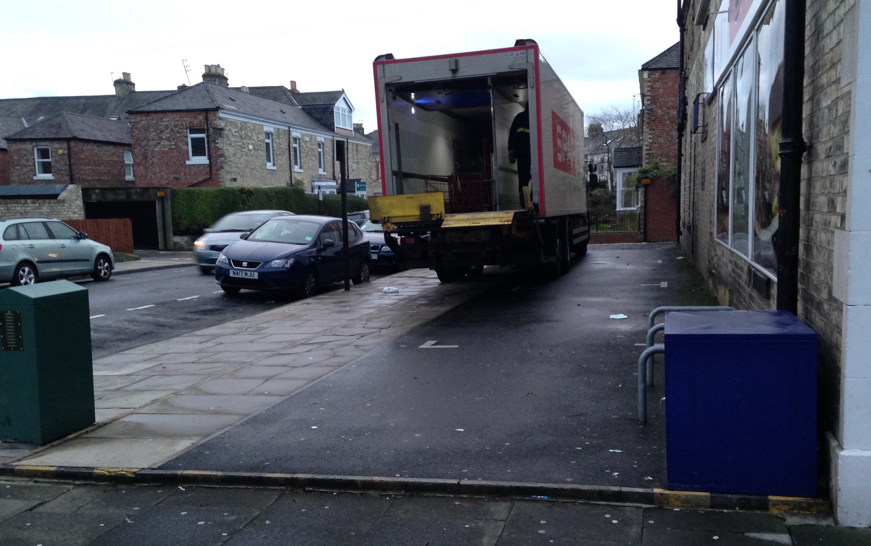
While not within the remit of the Council one area that could also be improved is the parking area to the side of the shop. The pavement alongside these parking spaces is broken and uneven due to drivers crossing the pavement or in the case of the delivery lorry, straddling the parking space and the pavement.
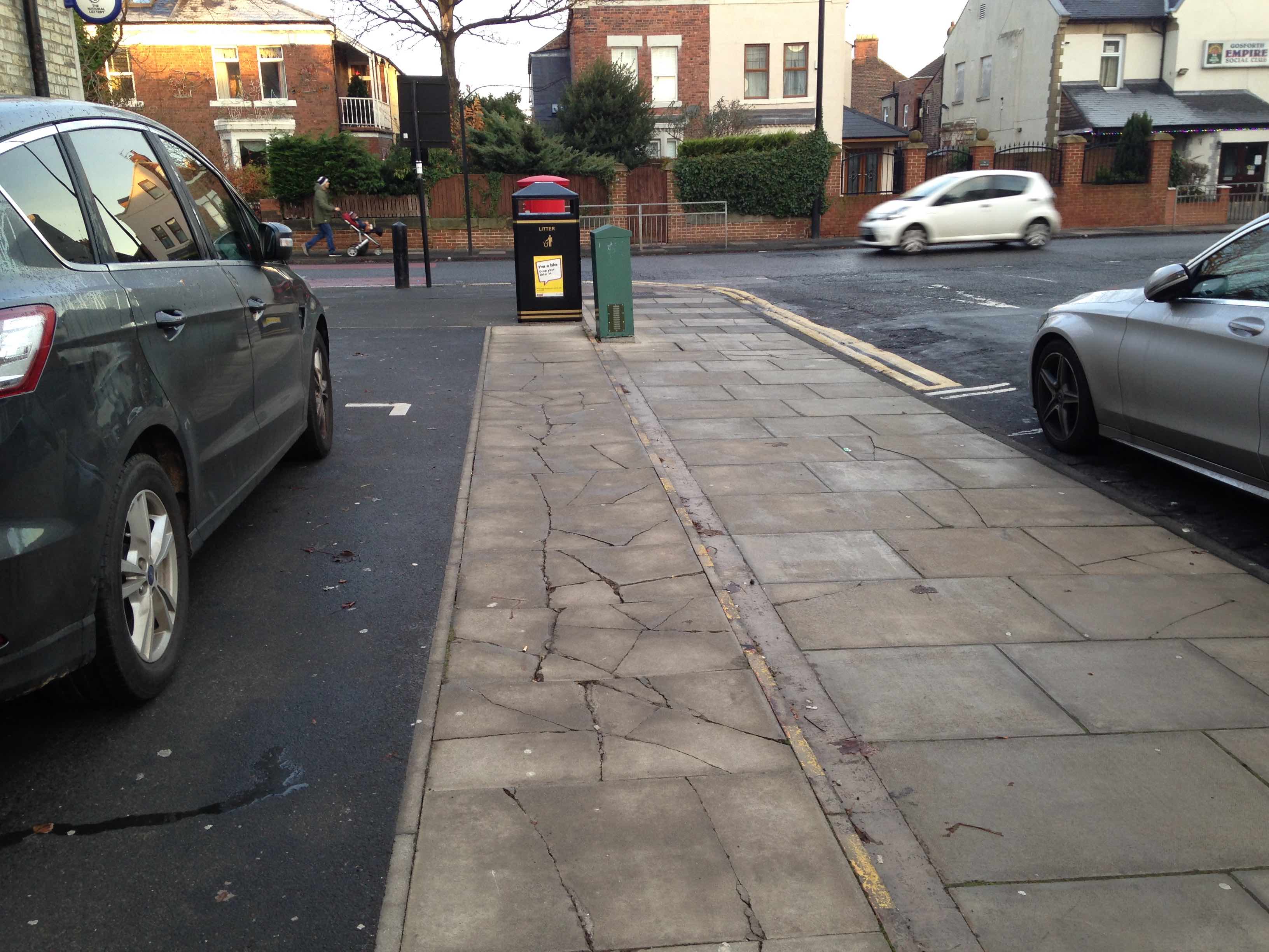
The “lip” that runs around this area is also a trip hazard for both people with good sight and visual impairments. Indeed while we were chatting, a gentleman tripped while cutting the corner. This corner is a frequent short cut for people heading to the High Street and walking down Ivy Road.
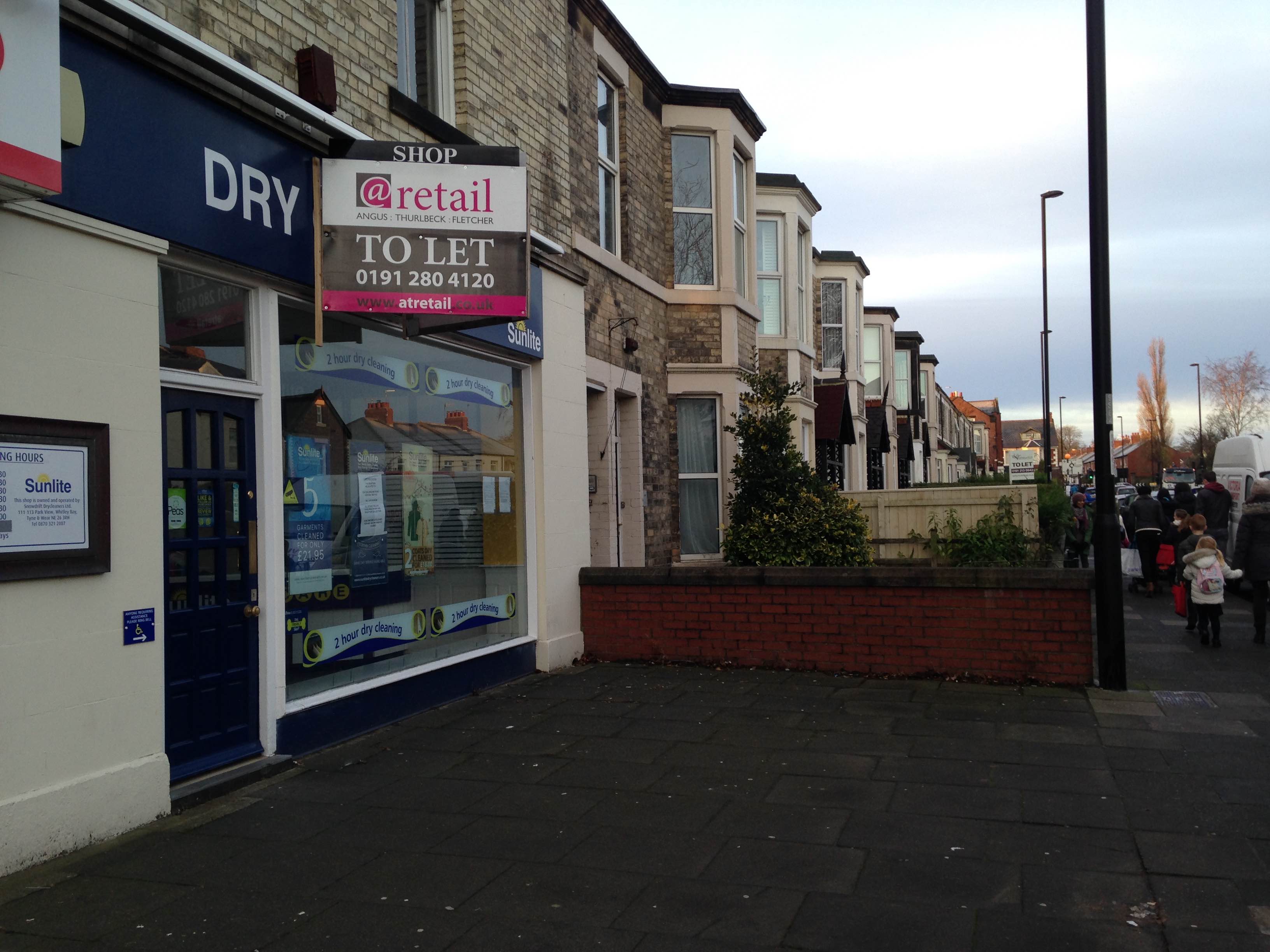
The cycle racks are ineffective, too low and too close to the wall. Most people lock their bikes against the railing on the ramp outside of the shop door.
SPACE recommends that the bicycle racks are installed against the wall by the dry cleaners. Leaving sufficient space away from the main pavement so as not to cause a trip hazard for people with visual impairments.
And finally…
SPACE for Gosforth believes that in addition to the signalised crossing the area outside of the shops could be improved with the changes suggested above, making the area more pleasant for people visiting the shops and Post Office.
The Spar and Post Office are both popular shops for local people, the crossing will be an asset to the shop and customers alike.
Living Streets Scotland, part of the UK charity for everyday walking has launched its updated research, ‘The Pedestrian Pound’ (7 December).
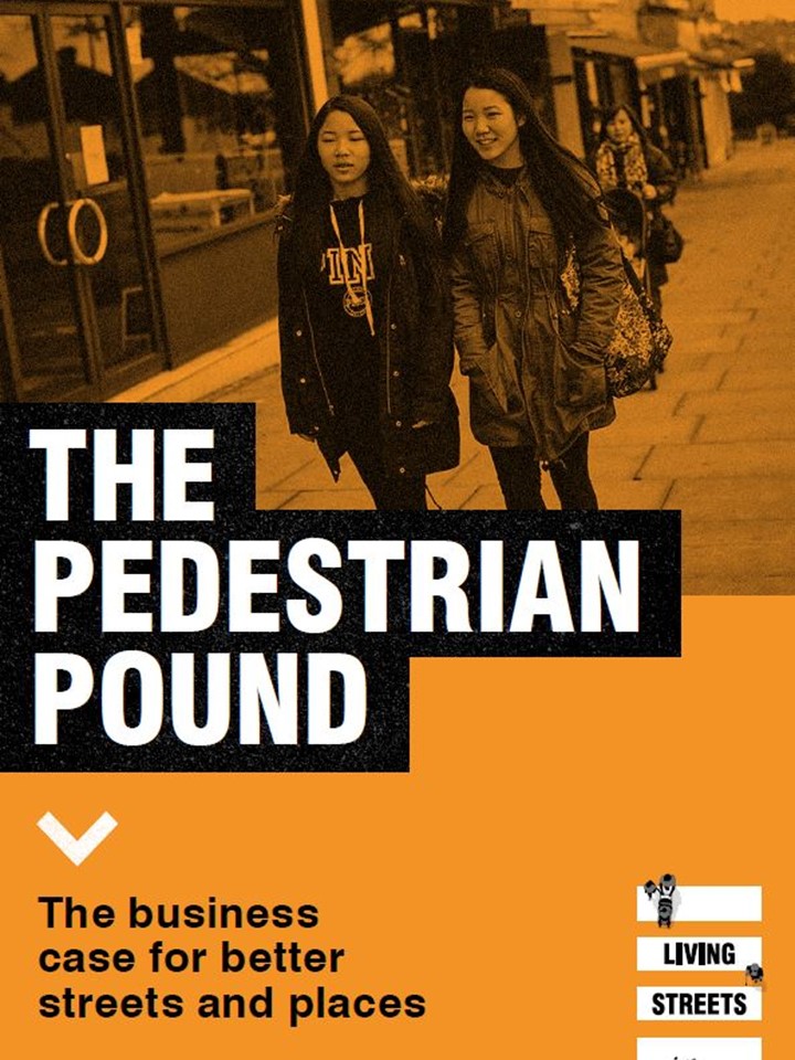 A review of academic evidence in the report shows that shoppers on foot can spend up to six times more than those who arrive by car, and that people value walkable destinations and investment in the public realm. Data on streets where the pedestrian experience has been improved shows footfall increasing 20-35 per cent.
This bucks a 22 per cent decline in footfall across the UK between 2007-2017. When streets are regenerated to boost walking, there is a corresponding impact on turnover, property values and rental yields. For well-designed projects, sales can increase by 30 per cent or more when footfall is boosted.
The secret to saving our High Street is in our feet!
Remember to submit your views for the crossing on the Let’s Talk website. Closing date is Sunday 23rd December 2018.
Update January 2022
The new pedestrian crossing has been installed.
The new pedestrian crossing is now working on Salters Road. Thank you to everyone who campaigned for or helped make this happen.@ArchibaldFirst @GosforthJunior pic.twitter.com/U3J1VQmtIE
— space for gosforth (@space4gosforth) January 21, 2022
Having the Post Office back, close to the High Street, was excellent news. i am sure that a new type of crossing will solve many obvious issues of allowing pedestrians to cross safely in a complex place where traffic – and people – appear from a variety of directions, trying to work out where each other is and where everybody else if planning to go.
There is, obviously, not just a pedestrian problem but also a car traffic management problem, which I would like to see being given equal priority.
Obviously parking has become a major issue now that both supermarket and post office function are in a place where the necessary parking provision has not been made. To say that somehow arriving on foot rather than by car is ignoring the fact that this postoffice is not in a location where drivers can easily park, first, and then arrive on foot: they want to park outside the store. They sometimes park three deep alongside the store in Ivy Road: in the spaces on the store’s land; by the kerb; and on the pavement between the two. It would be really smart to allow access to the spaces on store land only from the back alley end and to block access/exit in other directions. Of course the store can decide to allocate that space for parking but access over the pavement on three sides, partly over the pavement, is surely not sensible and needs to be managed.
Drivers in need of places to stop – sometimes to park, sometimes just to check their mobiles – will stop their cars wherever convenient, including on the corners themselves, on double yellow lines, on disabled spaces etc. How are hoping to manage this problem? Will moving the disabled space along Salters Road do this? Will white zigzag lines by a pedestrian crossing do this more effectively than double yellow lines? Is there traffic planning research to demonstrate that this has happened elsewhere?
There is a lot of traffic pressure on streets in Gosforth and a lot of car pollution in the High Street. Is it not possible to support directing traffic away from the centre of the suburb? I have in mind a large-scale roundabout to replace the existing Blue House roundabout and some cycle lanes in the Hight Street. You cannot delay this forever.
In your recent traffic survey, you published two versions of a questionnaire, a digital one and a hardcopy one. A question about cycle paths only appeared on one version (which I completed). What efforts are you making to scale the results correctly to show the cycle lane responses correctly in the final report? Will you have to repeat the exercise with just one version of the questionnaire?
Thank you for taking the time to reply, you make some good points.
To pick up on your points – car traffic management is a problem – the reality is that too many of us choose a car to get around and our roads don’t have the sufficient bandwidth to support the volumes. We must provide suitable economically viable alternatives, those obviously being public transport, cycling and walking.
I’m assuming you’re addressing the question of parking around the shop and the traffic pressures to the City Council? We can give our viewpoint if you’d like?
Regarding question of the survey on cycle lanes – the question does appear in both online and printed but it was worded differently – print had ” Traffic-free cycle lanes” (due to print space) and the online version had “Safe all age/ability cycle facilities on main roads” – this was a small mistake but as the question is almost identical (other than the number of words) it won’t affect the final outcome. Thanks for responding.