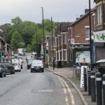
 Residents have reported high volumes of motor traffic and delays on Station Road, with this often being attributed to the effect of closing a number of minor roads to through traffic in 2020. In this blog we take another look at local traffic count data to see what is going on.
Read more [...]
Residents have reported high volumes of motor traffic and delays on Station Road, with this often being attributed to the effect of closing a number of minor roads to through traffic in 2020. In this blog we take another look at local traffic count data to see what is going on.
Read more [...] Station Road traffic went up – what happened?
Residents have reported high volumes of motor traffic and delays on Station Road, with this often being attributed to the effect of closing a number of minor roads to through traffic in 2020. In this blog we take another look at local traffic count data to see what is going on.
Read more [...]  In this blog we assess the impact of Haddricks Mill roadworks and closing Dene Bridge to motor vehicles.
Just like for Stoneyhurst Road and Salters Bridge, a large proportion of people who responded to the Dene Bridge consultation thought that it would result in displaced traffic and additional congestion on surrounding roads.
In this blog we assess the impact of Haddricks Mill roadworks and closing Dene Bridge to motor vehicles.
Just like for Stoneyhurst Road and Salters Bridge, a large proportion of people who responded to the Dene Bridge consultation thought that it would result in displaced traffic and additional congestion on surrounding roads. 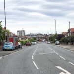 Newcastle City Council confirmed in February, following an eighteen-month trial and six-month consultation, that the arrangements at Stoneyhurst, Dene and Salters Bridges would be made permanent to help make local streets safer, cut carbon emissions from driving and promote active travel.
  It is now over eighteen months since wands were installed on Gosforth High Street as part of the Council's response to Covid. This blog looks beyond the look and feel of the wands, focusing instead on their impact on traffic volumes, air pollution and road safety, and suggests specific actions that could be taken to help the High Street thrive in future.
  In March 2020, the Secretary of State for Transport said "Public transport and active travel will be the natural first choice for our daily activities. We will use our cars less and be able to rely on a convenient, cost-effective and coherent public transport network." This begs the question how much less will we use our cars?
 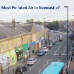 The Council has just released its Air Quality Annual Status Report 2018 and it is not looking good for Gosforth High Street. We had expected that the 2016 reading of 51μg/m3 for Nitrogen Dioxide (NO2) was a one-off due to the roadworks at the junction with Salters Road, but in 2017 the figure had increased again to 59μg/m3.. Both are substantially higher than the legal maximum of 40μg/m3.
 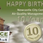 2018 is the 10th anniversary of the Gosforth & Grainger Town Air Quality Management Areas. Will this local election year bring decisive action to clean our filthy air?
 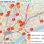 Every year the Council is required to provide an annual status report covering its Air Quality Management Areas (AQMA) in the City Centre and in Gosforth. Figures have just been released for 2016 and, contrary to the longer term trend, there were significant increases in pollution across many sites in Gosforth and in the City Centre.
  Blue House, Gosforth High Street, electric bikes, guest speakers and much much more - a year in the life of SPACE for Gosforth!
 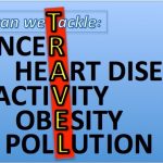 On 12 April, six days before the General Election was announced, the Evening Standard published an article quoting Theresa May stating that toxic air pollution is the fourth biggest public health risk behind cancer, obesity and heart disease.